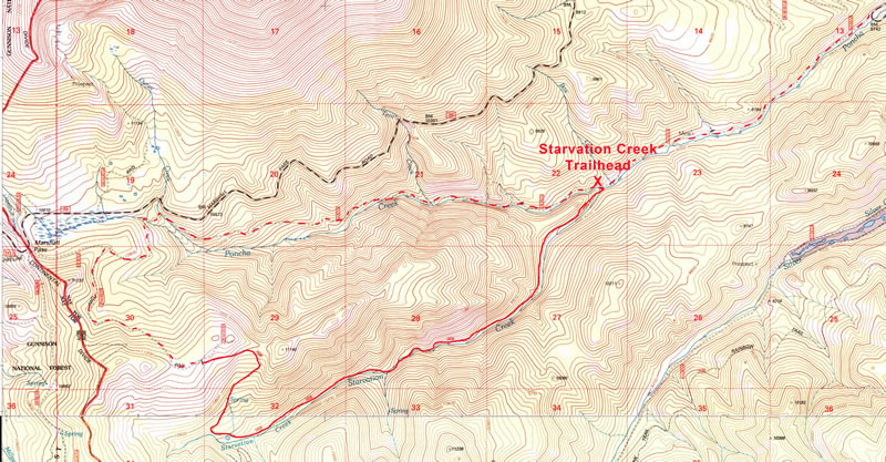
Starvation Creek is an out and back trail run which takes place in the dark forest and deep recess of Starvation Creek Canyon. Half the fun of this run is getting to the trailhead. South of Poncha Springs on Hwy 285 five miles to Mears Junction (CR 200). Turn right on CR 200 and continue 3.2 miles to where the road crosses Poncha Creek and switches back down the valley. Take a left turn on Forest Road 203 and drive about 2.4 miles to the Starvation Creek Trailhead.
The trail begins with a bridge over Poncha Creek, over a hump then proceeding southwest up Starvation Creek. The trail is about 5 miles long and can easily be made into an 11 mile loop by turning left on the dirt road at the end of the trail. After 1.5 miles that road tees. Take a right into the Poncha Creek Drainage and back to the car. This run can be lengthened by 4.8 miles by starting your run from the junction of CR 200 and Forest Road 203.
In the fall, the Starvation Creek drainage if full of a variety of mushrooms including the sought after king boletus.