
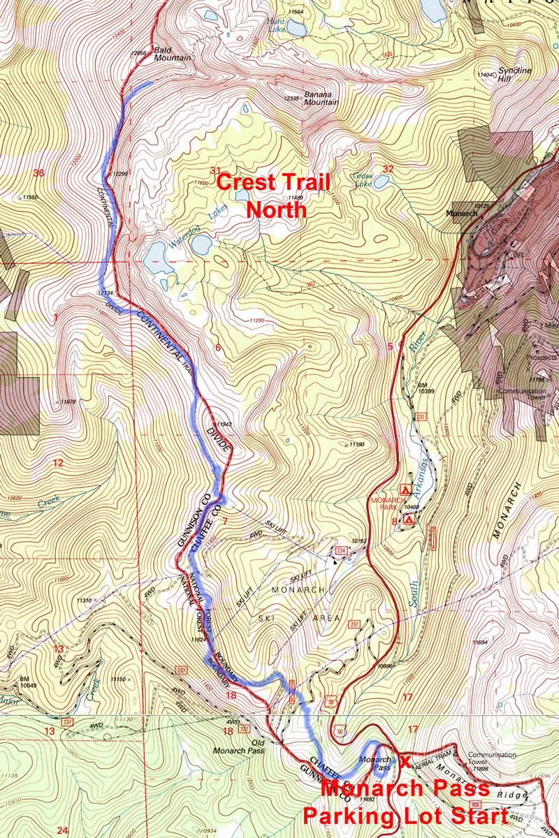
Crest Trail North starts at the Monarch Pass Parking lot on Hwy 50.
Local Routes
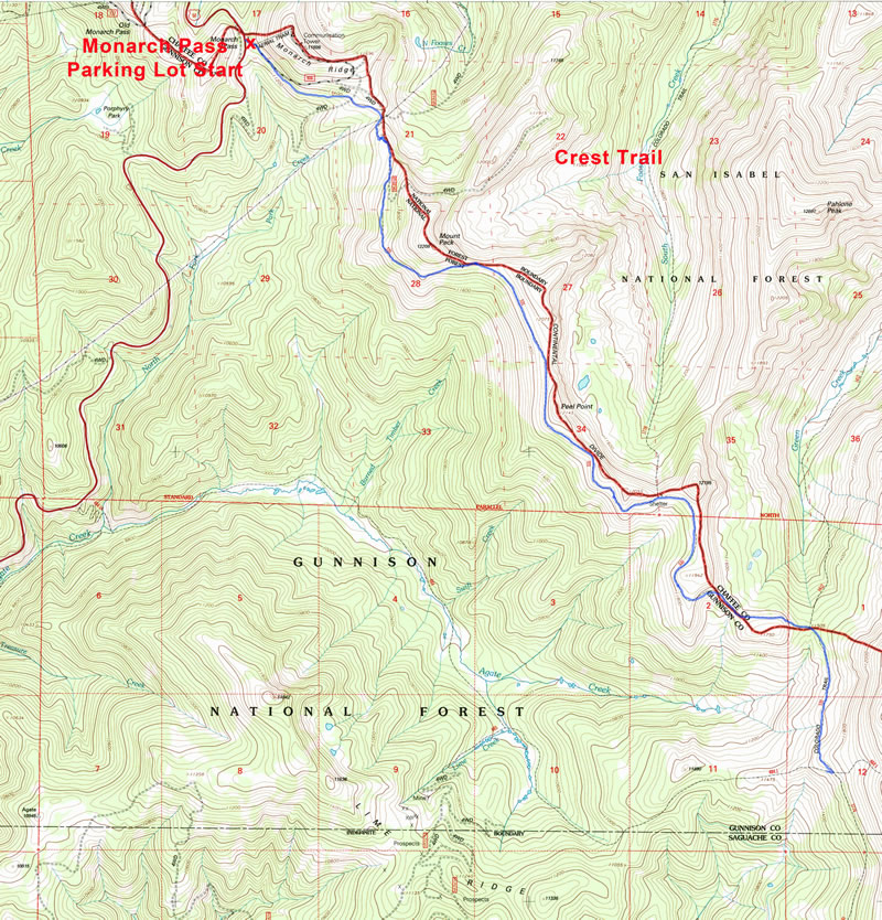
Boss Lake Loop
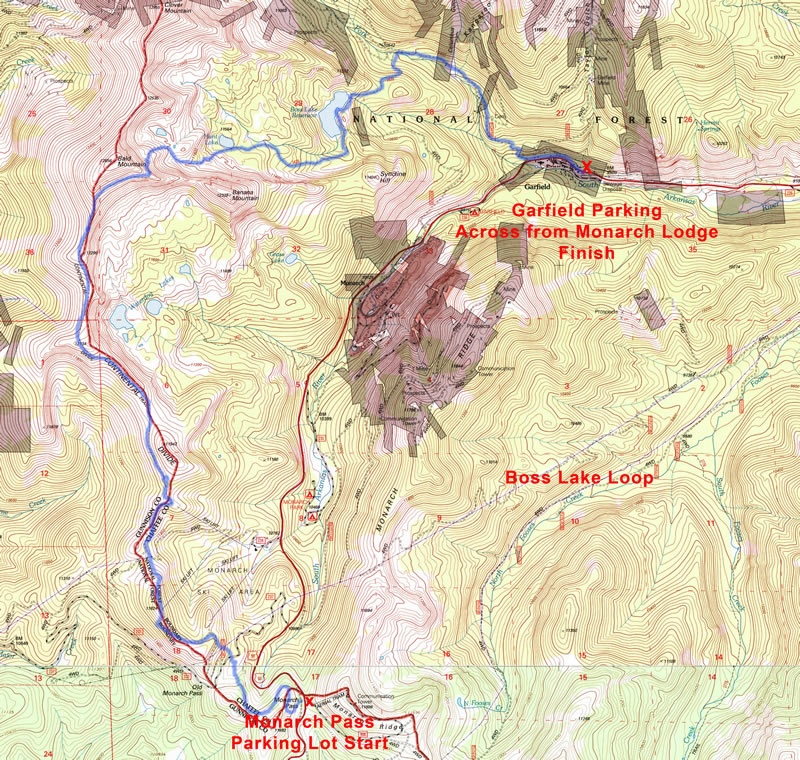
We call this the Boss Lake Loop but rather it’s a point to point run and requires two cars or one car with a shuttle person. Drive to Monarch Pass, dropping one car at the wide spot parking area across from the Monarch Lodge. Park the other car(s) at the Monarch Pass Parking Lot.
6.35 mile River Road Loop Salida
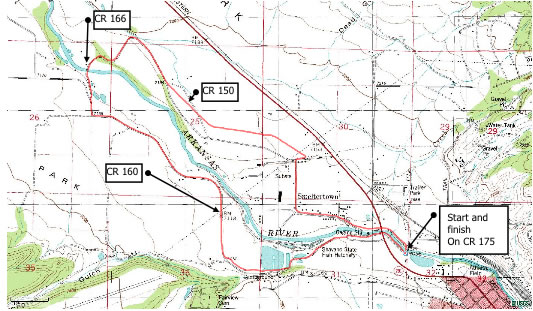
This is a pleasant, relatively flat, smooth & continuous loop above Salida. The loop is mainly on low traffic paved county roads. There are no road crossings or intersections to deal with, so it lends itself to uninterrupted running. There is only 550’ of climbing, with the same amount of descent.
Fooses Creek
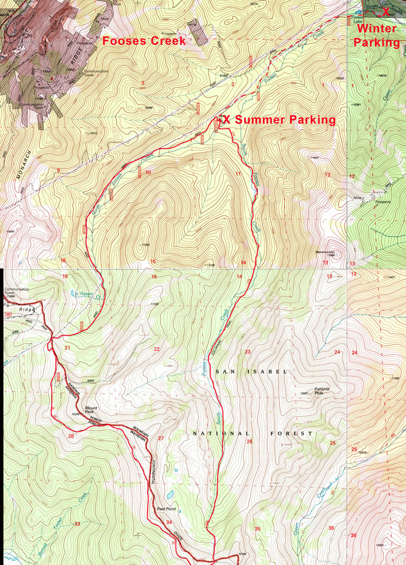
Access: Fooses Creek can be accessed off Hwy 50, 2.9 miles west of Maysville, CO, turn left on CR 225. In the winter the road ends below the lake, in the summer you can drive 2.5 miles further to the South Fooses Creek trailhead.
Greens Creek
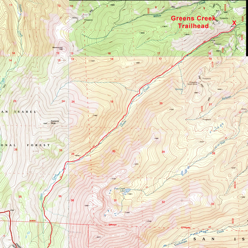
Greens Creek can be accessed by driving west from Poncha Springs down Hwy 50 to CR 220, turn left and parallel Hwy 50 for a couple of miles until you hit CR 221 and turn left again and go 2.5 miles to the Greens Creek Trailhead.
Pass Creek
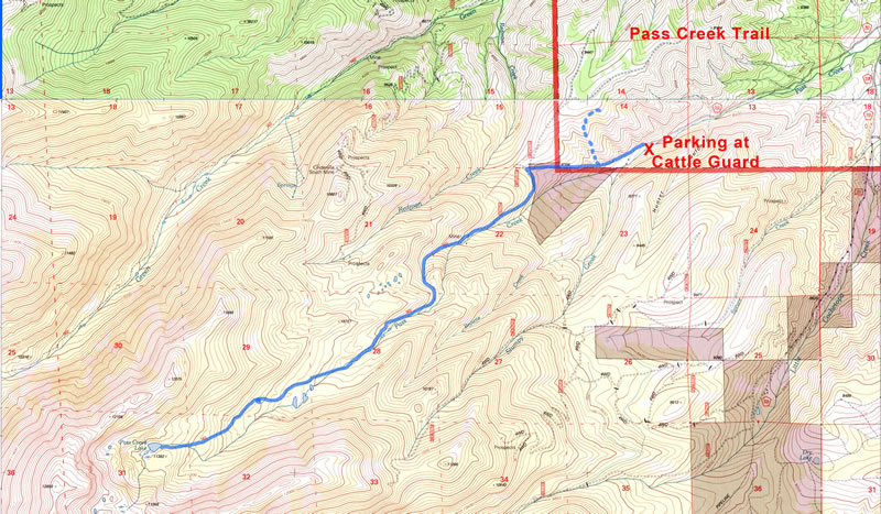
Access: Pass Creek may be accessed off Highway 50 west of Poncha Springs. Take CR 210 south up Little Cochatopa Creek. In a short distance (2 miles) CR 212 branches off to the west or right off 210. It is marked with a sign saying Pass Creek. Follow this road up to a cattle guard with a wide spot for parking on the left.
Starvation Creek
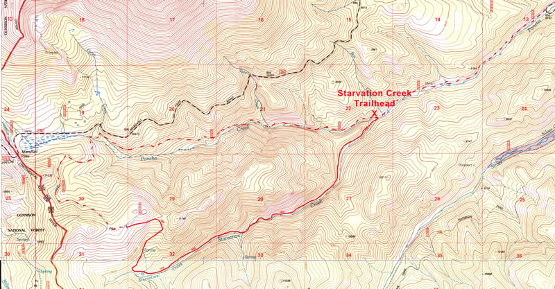
Starvation Creek is an out and back trail run which takes place in the dark forest and deep recess of Starvation Creek Canyon. Half the fun of this run is getting to the trailhead.
West Rainbow Trail Run
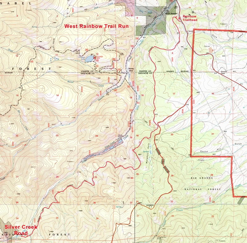
The West Rainbow Trail Run is an out and back trail run which starts at the Rainbow Trailhead off 285 just south of Mears Junction. This is where the Rainbow Trail crosses 285.
Rainbow Trail “Puke Run”
This is a point to point run along the Rainbow Trail. It gets its name because it was an annual run which ended at Terry Pintane’s house where we would have pot luck dinner.